 August 24, 2020 2:40 pm
Published by Jenny Rislund
August 24, 2020 2:40 pm
Published by Jenny Rislund
In this project the student will apply a new algorithm to map the expansion of cities across Southeast Asia. Combining this with proxies of energy consumption and fossil fuel emission the student will establish trends in regional emissions and project these emission trends into the future.
 August 6, 2020 3:47 pm
Published by Jenny Rislund
August 6, 2020 3:47 pm
Published by Jenny Rislund
In this project you will investigate the competing effects the Antarctic ozone hole and increasing greenhouse gases have on the Australian summer season rainfall, using the latest climate models. These are now available on the National Computing Infrastructure (NCI) supercomputer and are being used as input into the Intergovernmental Panel on Climate Change’s Sixth Assessment Report.
 August 6, 2020 3:46 pm
Published by Jenny Rislund
August 6, 2020 3:46 pm
Published by Jenny Rislund
Using unique observations from recent field campaigns, this project aims to quantify the amount of precipitation associated with different low-level cloud morphologies during cold-air outbreaks over the Southern Ocean.
 August 6, 2020 1:47 pm
Published by Jenny Rislund
August 6, 2020 1:47 pm
Published by Jenny Rislund
This project will focus on the connection between conceptual climate models and high resolution general circulation models (GCMs). The student will analyse simplified models that represent teleconnection behaviour and calibrate them to reflect the settings of a GCM. The student will also have access to high dimensional GCM output and can compare an ensemble of “real-world” simulations to the behaviour of the conceptual model using statistical methods.
 August 6, 2020 1:46 pm
Published by Jenny Rislund
August 6, 2020 1:46 pm
Published by Jenny Rislund
Understanding historical changes in extreme sea levels is necessary for the accurate projection of their changes over the next century. This project will look at digitized sea level data, to better understand the causes of extreme sea levels the southern Australian region and how these events vary over the duration of the record.
 August 6, 2020 1:45 pm
Published by Jenny Rislund
August 6, 2020 1:45 pm
Published by Jenny Rislund
The student will produce estimates of the future evolution of ozone depleting substance concentrations, so the recovery date of the ozone hole can be estimated. Importantly, it will also be possible to estimate the uncertainty around the recovery date.
 August 6, 2020 1:35 pm
Published by Jenny Rislund
August 6, 2020 1:35 pm
Published by Jenny Rislund
What would happen if we suddenly warmed the entire ocean at the sea-surface? Would suddenly cooling it down cause an equal and opposite response? Using ocean climate models we have carried out these and many more extreme experiments. The student will explore the asymmetric and often surprising behaviour of the ocean.
 August 6, 2020 1:30 pm
Published by Jenny Rislund
August 6, 2020 1:30 pm
Published by Jenny Rislund
Errors in identifying the fire scar - the portion of a long-lasting bushfire that is actively burning or smouldering, are the largest errors in forecasting emissions from these events. This project will develop and analyse fire progression tracking using data from the 2019 - 2020 bushfire season.
 August 6, 2020 1:29 pm
Published by Jenny Rislund
August 6, 2020 1:29 pm
Published by Jenny Rislund
Dryness is defined by ratio of accumulated annual rainfall and potential evapotranspiration (PET). Understanding changes in dryness will help stakeholders and policy makers making long-term plans in water management and mitigation/adaptation. In this study, the 50-km resolution climate simulations from the NARCliM outer domain will be used to assess the future changes in dryness.
 August 6, 2020 1:27 pm
Published by Jenny Rislund
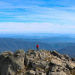
August 6, 2020 1:27 pm
Published by Jenny Rislund
The Australian Alps are the highest mountain range in Australia and is an important region in terms of ecosystem, biodiversity, energy generation and winter tourism. Alpine areas are vulnerable to climate change. This project will use NARCLiM simulations to analyse the relationship between warming rates and changes in albedo and surface energy budget.