- Tropical Cyclone Jasper made landfall north of Cairns on 13th December bringing strong winds, significant rainfall and flooding.
- Jasper stalled as a weak tropical low over Cape York, contributing further rainfall and flooding over far north Queensland.
- Jasper caused evacuations, power outages, disruption of supply chains and damage to tourism and agriculture.
In mid-December, Tropical Cyclone Jasper hit tropical north Queensland, unleashing formidable winds, torrential rainfall and flooding. Following landfall, the cyclone stalled as a tropical low over Cape York, contributing to a week of continuous torrential rainfall. The prolonged deluge inflicted extensive damage across eastern parts of Cape York contributing to a week of continuous torrential rainfall.
Tropical Cyclone Jasper developed in the northern Coral Sea on 5th December 2023. It made landfall as a category 2 tropical cyclone near Bloomfield on the north Queensland coast on 13th December 2023.
Strong winds felled trees, damaged crops and infrastructure and caused power cuts. Between 150-350 mm of rain fell over the coastal areas between Cooktown and Innisfall over a 36-hour period. This resulted in flooding in the Mossman and Daintree River catchments.
The worst of the destruction was yet to come. The cyclone was downgraded to a tropical low as it headed towards the Gulf of Carpentaria. The tropical low slowed and stalled over the Cape York Peninsula.
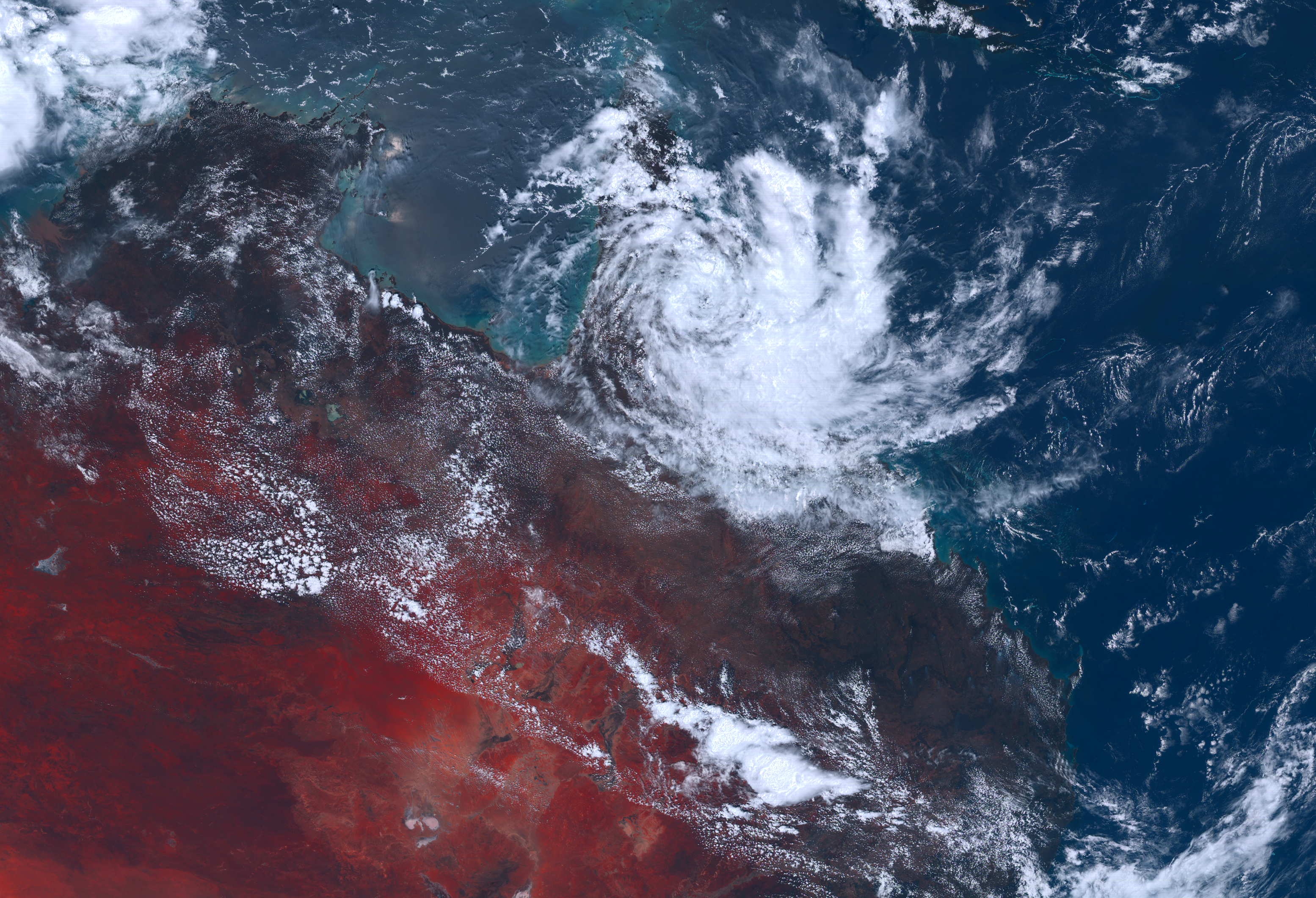
The location of the stalled weather system produced persistent, northerly winds bringing moisture to the region from the Coral Sea. The moist northerlies collided with south-easterly trade winds over the Peninsula, producing torrential rainfall over the region for several days. A large region of far north Queensland received over 400 mm of rainfall. Isolated areas received particularly heavy rainfall with some stations recording over 2 metres of rainfall over the course of the event.
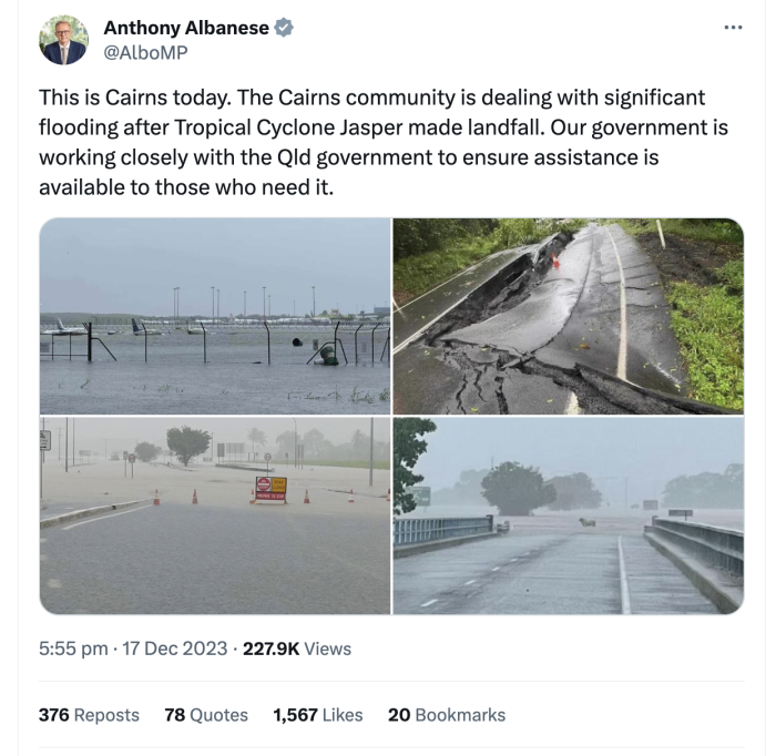
The persistence and intensity of the rainfall flooded multiple catchments in the region. Widespread damage to roads, buildings, crops and loss of power was experienced. Cairns airport was closed for several days with rising floodwaters halting both incoming and outgoing flights. The Barron Gorge hydro plant near Cairns was damaged, taking 66MW off the grid. The event occurred before a busy Christmas tourism period, hurting the hugely important local tourism economy with multiple cancelled holidays.
Jasper caused arguably more damage in the days after its landfall (as a weak tropical low) rather than during its approach and landfall as a category 2 tropical cyclone. This is primarily the result of the system stalling.
Far north Queensland has experienced stalled tropical lows in the past, most notably during February 2019 when a stalled tropical low produced heavy rainfall and flooding over Townsville. Recent work by the ARC Centre of Excellence for Climate Extremes researchers has shown that this was the result of weak winds in the mid-troposphere that allowed the tropical low to remain stationary. Other research themes such as tropical lows, tropical convergence lines and stalled weather systems are also being addressed within the Centre to further enhance our understanding of tropical rainfall extremes.
Research contacts:
Dr Michael Barnes, michael.barnes@monash.edu Corey Robinson, corey.robinson@monash.edu