- Gippsland experienced unseasonably early spring bushfires.
- A strong cut-off low extinguished the fires but caused widespread flooding.
- Centre research is trying to understand how these weather features may behave in the future.
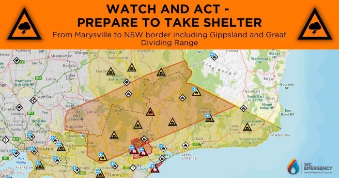
The Gippsland region of eastern Victoria experienced compounding fires and floods during the first week of October 2023 (Figure 1).
Gippsland receives the bulk of its rainfall between late autumn and early spring. Temperatures during winter were above average while rainfall was below average, producing a dry landscape. September 2023 received less than 40% of the typical September rainfall. Dried vegetation is a critical ingredient for runaway wildfires, providing the fuel required for the unseasonably early bushfires.
On 30th September, the warm, dry, gusty north-westerly winds ahead of a cold front fanned the fires over the dry landscape. The fires spread, becoming out of control in the Briagolong, Loch Sport and Walhalla regions.
A second, much more intense, cold front affected the region from 2nd October (Figure 2). The intense frontal system was again associated with warm and gusty north-westerly winds ahead of it, fanning fires further. As the cold front moved over Victoria, the atmospheric waves (Rossby waves) supporting the weather system broke. The result was the generation of a cut-off low that broke away from the strong winds to the south, and further intensification of the cold front. The weather system’s intensity and northward extent promoted the transport of enhanced moisture from tropical Australia – known as an atmospheric river. The moisture fed into the slow-moving weather system and produced prolonged, widespread rainfall over eastern Victoria.
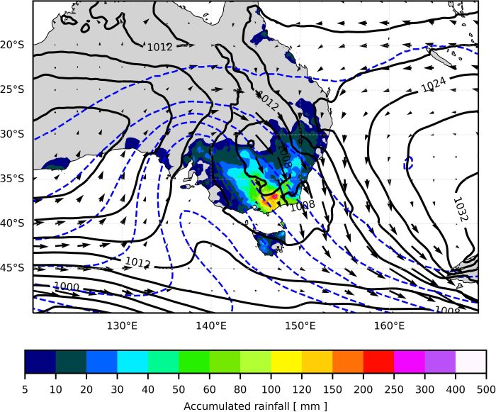
Over 200 mm of rain fell over the region in under 48 hours. Although this terminated the fires, the rainfall caused substantial flooding and destruction over the region. About 130 properties were flooded and the SES received 300 calls in 24 hours on 3-4 October.
Hot and dry winters make Australia more prone to early season fires. Additionally, a warmer atmosphere can hold more moisture, making heavier falls more likely when rain does occur. However, future changes to the intensity and frequency of weather features that produce fire and flooding extremes are uncertain. Ongoing work within the ARC Centre of Excellence for Climate Extremes aims to understand compound events, atmospheric rivers, Rossby wave breaking and lows to guide our understanding of future extremes.
Research contacts:
Dr Michael Barnes, michael.barnes@monash.edu Dr Kim Reid, kim.reid@monash.edu