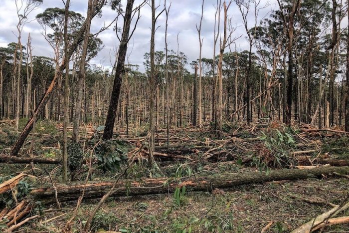
A storm caused widespread wind damage across southeast Australia between 9th and 11th June 2021, with gusts exceeding 100 km/h in some areas.
The storm also caused flash flooding in parts of eastern Victoria, with 3-day rainfall totals ranging between 100-300 mm, approximately twice the average rainfall total for June.
The combination of wet soils from the rainfall, and the unusual wind direction (from the southeast) led to large areas of damaged forests, power outages to more than 200,000 premises and two deaths.
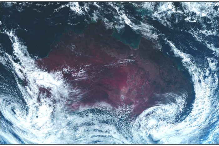
This event was driven by an intense coastal low-pressure system, known as an East Coast Low, which formed along a strong cold front that passed over the southeast on the 7th and 8th June.The East Coast Low was clearly visible in satellite images.
Another severe windstorm occurred on 28th and 29th October 2021, bringing localised heavy rain and damaging wind to southern Victoria and Tasmania.
Winds gusted to 146 km/h in the extreme south of Victoria and parts of Melbourne recorded their strongest October wind gusts for more than a decade. Approximately 526,000 Victorian homes and businesses, almost 25% of Victorian properties, were without power on the morning of the 29th.
The event was mainly driven by a rapidly intensifying low-pressure system, which developed on a low-pressure trough moving eastwards from South Australia.
Some types of weather system that bring extreme winds to southeast Australia, such as cold fronts and East Coast Lows, may be in decline during the cooler months of the year.
However, the link between damaging winds and human-induced climate change is unclear. Ongoing research by the ARC Centre of Excellence for Climate Extremes improves our understanding and modelling of the processes that lead to severe winds in Australia and estimate the potential effects of climate change.