 August 3, 2023 9:51 am
Published by Climate Extremes
August 3, 2023 9:51 am
Published by Climate Extremes
Sea ice covers approximately 9% of the global oceans at least part of the year, and plays an important role governing heat and freshwater fluxes between the ocean and atmosphere. The heat flux through the sea ice from the relatively warm -2oC ocean to the cooler -30oC atmosphere is a vital process in the formation of cold dense shelf waters that eventually become the deep and bottom waters filling the abyss and maintaining the global ocean overturning circulation. The thermal... View Article
 August 3, 2023 9:50 am
Published by Climate Extremes
August 3, 2023 9:50 am
Published by Climate Extremes
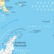
The Antarctic Circumpolar Current (ACC) connects all major ocean basins and plays the leading oceanic role in Earth’s climate. The existence of the ACC is only possible because the Drake Passage, which separates South America and the Antarctic Peninsula, is currently open to an average depth of approximately 4000m. This hasn’t always been the case; throughout geological history the Drake Passage has been shallower, and even completely closed, which had substantial consequences for the ACC. This project investigates the effect... View Article
 August 3, 2023 9:49 am
Published by Climate Extremes
August 3, 2023 9:49 am
Published by Climate Extremes
This project will investigate the frequency and intensity of Australian drought in stable warmer and cooler climates. The student will utilise two 1000-year runs of the CESM climate model run under doubled and halved CO2 conditions relative to pre-industrial. These new climates are both warmer and cooler, but also have stronger and weaker El Nino events respectively compared to pre-industrial climate. This project will first quantify drought statistics in each simulation, then aim to understand the links between changes in... View Article
 August 3, 2023 9:25 am
Published by Climate Extremes
August 3, 2023 9:25 am
Published by Climate Extremes
Since the early 1990s, Autumn rainfall has been declining in southeast Australia, particularly through Victoria, southeast South Australia and eastern Tasmania. This ongoing trend has been linked to changes in a number of factors on monthly and longer time scales, including changes to the strength of the subtropical ridge and other remote factors including modes of climate variability. However, the key feature of the decline is the absence of months of high rainfall. Recent work by our group has shown... View Article
 August 3, 2023 9:24 am
Published by Climate Extremes
August 3, 2023 9:24 am
Published by Climate Extremes
Volcanic eruptions inject dust particles and other gases into the atmosphere leading to substantial changes in atmospheric temperature and circulation. The volcanically forced climate response is also important because it has similarities to the potential effects of geoengineering techniques. This project aims to examine the impacts of volcanic eruptions on extreme events (e.g., heatwaves, floods, …) in Australia. We will analyze the observations, reanalysis, and model simulations (VolMIP multi-model) and focus on the intraseasonal (e.g., 30-90 days) timescale. By doing... View Article
 August 3, 2023 9:23 am
Published by Climate Extremes
August 3, 2023 9:23 am
Published by Climate Extremes
To mitigate the risk posed by extreme rainfall events, we require statistical models that allow us to extrapolate outside the range of our observed data into the tail of our distribution and to estimate the probability of record events we are yet to observe. For this type of statistical analysis, we typically use methods from extreme value theory. The challenge for modelling rainfall extremes using many of these extreme value methods is that there exists a gap between statistical theory... View Article
 August 3, 2023 9:22 am
Published by Climate Extremes
August 3, 2023 9:22 am
Published by Climate Extremes
The El Niño-Southern Oscillation plays a significant role in modulating rainfall variability in eastern Australia. This project will examine the diversity in ENSO, and other underlying environmental conditions, during years with large versus small rainfall anomalies. This is, you will examine very dry or very wet years in response to El Niño or La Niña, versus those years that are only moderately dry or wet during El Niño and La Niña. The project will look for consistency in underlying environmental... View Article
 July 13, 2023 12:20 pm
Published by Climate Extremes
July 13, 2023 12:20 pm
Published by Climate Extremes
Leveraging artificial intelligence (AI) to detect weather features, such as atmospheric rivers, fronts, and tropical cyclones, holds great promise in advancing our understanding and prediction of extreme precipitation events.
 March 21, 2023 12:03 pm
Published by Climate Extremes
March 21, 2023 12:03 pm
Published by Climate Extremes
I learnt the benefits of reaching out through e-mail while I was a student, now I receive many cold e-mails myself. Here’s how to write a good one.