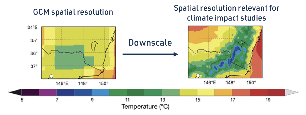
Global climate models (GCM) are limited to looking at large scale processes providing information at a 50 – 250 km scale, whereas decision makers are typically looking at how impacts will be experienced at a local level.
Researchers use a process called ‘downscaling’ to look at regional climate influences and information such as topography at a local scale.

Different methods are used on Global Climate Model outputs to translate the information to finer resolutions. The most commonly used methods are statistical downscaling and dynamical downscaling.
What is statistical downscaling?
This method uses observed data to establish a statistical relationship between the global and local climate.
Researchers use this to draw conclusions about local changes based on the large-scale projections coming from GCMs or observations. For example, observed relationships between local weather and the large-scale climate are used to build the statistical model. This can then be used to judge local-scale changes from large-scale changes generated by Global Climate Models.
What is dynamical downscaling?
This method involves running a climate model at fine resolution using the Global Climate Model to provide the large-scale boundary conditions.
Some dynamical downscaling is done globally, and some is done regionally using regional climate models (RCMs). This can be computationally very expensive and time-consuming. Crucially, downscaled products still retain biases from the Global Climate Model used to provide information, as well as biases inherent in the Regional Climate Model – that is, all Regional Climate Model downscaling products have uncertainties.
Climate model stakeholder
How do you choose the right climate model?
What does climate model resolution mean?