- Severe winds impacted parts of South Australia and the Northern Territory On the 12th of November 2022.
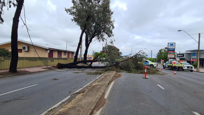
- Damage included failure of transmission lines in South Australia and damage to buildings, including the removal of a roof off of a school in the Northern Territory.
On the 12th of November 2022, severe thunderstorms impacted parts of South Australia and the Northern Territory, producing strong winds causing significant damage near Adelaide and Alice Springs. These thunderstorms were part of a broader region of severe weather that developed along a trough of low pressure extending through central Australia. These types of strong wind events generally begin by the evaporation and melting of water and ice in thunderstorm clouds. This produces cold, dense air that sinks, leading to “downdrafts” that can rapidly descend towards the surface and cause gusty conditions on the ground.
Storms began near Adelaide at around 12:00 pm Australian Central Standard Time (ACST) in the Spencer Gulf and travelled eastwards before reaching Adelaide at around 3:00 pm ACST. At that time, the storms were organised in a line around 140 km long. These types of ‘linear’ systems often impact southern Australia, sometimes bringing heavy and extreme rainfall.
The system also included a curved or ‘bowing’ segment, indicating strong winds at the surface.
The winds produced by this system caused widespread damage to the electricity network, with nearly 500 reports of downed overhead wires, services to 163,000 electricity customers affected, and the failure of high-voltage transmission infrastructure causing an isolation of South Australia from the National Energy Market. A weather station at Parafield airport recorded a maximum gust of 106 km/h at around 3:00 pm ACST. However, the transmission line failure suggests even stronger gusts occurred. Weather stations only represent winds at a single point, so they may not always capture a thunderstorm’s strongest gust.
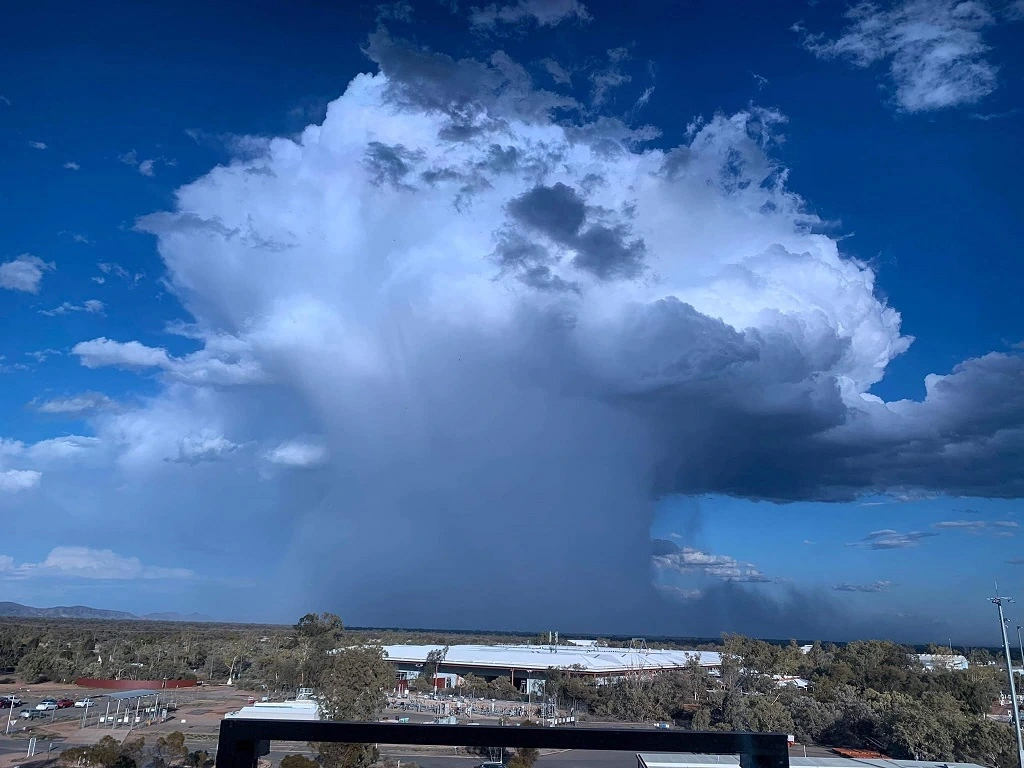
The thunderstorm in Alice Springs was very different to those in the Adelaide region. The storm was around 10 km across when it impacted the town at approximately 5:30 pm ACST. The small size and strong winds associated with this thunderstorm suggest that it was a “microburst” event. Microbursts occur when thunderstorms begin over regions where there is a deep layer of hot, dry air near the surface, such as in central Australia. This hot, dry air encourages rain to evaporate as it falls out of the cloud, leading to more cooling, stronger downdrafts, and intense surface winds. The gust produced by this microburst was brief, but caused damage to several buildings, including removing the roof of a local school. The strongest gust recorded at Alice Springs Airport during this event was 76 km/h, but the structural damage indicates gusts were at least 100 km/h!
Winds from thunderstorms are challenging to observe and predict because of the short-lived and localised nature of severe thunderstorm impacts. Although we expect an increase in the energy available for thunderstorms under climate change, there are significant uncertainties in explaining how locally damaging winds might vary. Within the Centre, researchers are currently trying to understand the characteristics and types of locally damaging wind events that have occurred using historical data and simulations from computer models, with the aim of improving climate predictions, and providing better information for designing infrastructure.
Main research contact: Andrew Lawrence Brown | andrewb1@student.unimelb.edu.au Dr Stacey Hitchcock | stacey.hitchcock@unimelb.edu.au Dr Moutassem El Rafei | m.el_rafei@unsw.edu.au
The State of Weather and Climate Extremes 2022
Weather and climate extremes in Antarctica
Extreme events in 2022
Heatwaves in Western Australia
Extreme rainfall and flooding in Queensland and New South Wales February-March 2022
Record low Antarctic sea ice extent in 2022
Simultaneous Antarctic and Arctic heatwaves
Collapse of East Antarctic Conger ice shelf
Hailstorms in Queensland, Victoria and New South Wales
Damaging wind gusts in South Australia and the Northern Territory
© 2023 ARC Centre of Excellence for Climate Extremes
References and acknowledgements available in the PDF version available here.
Materials used are for educational purposes and either author provided or used under fair dealing provisions.