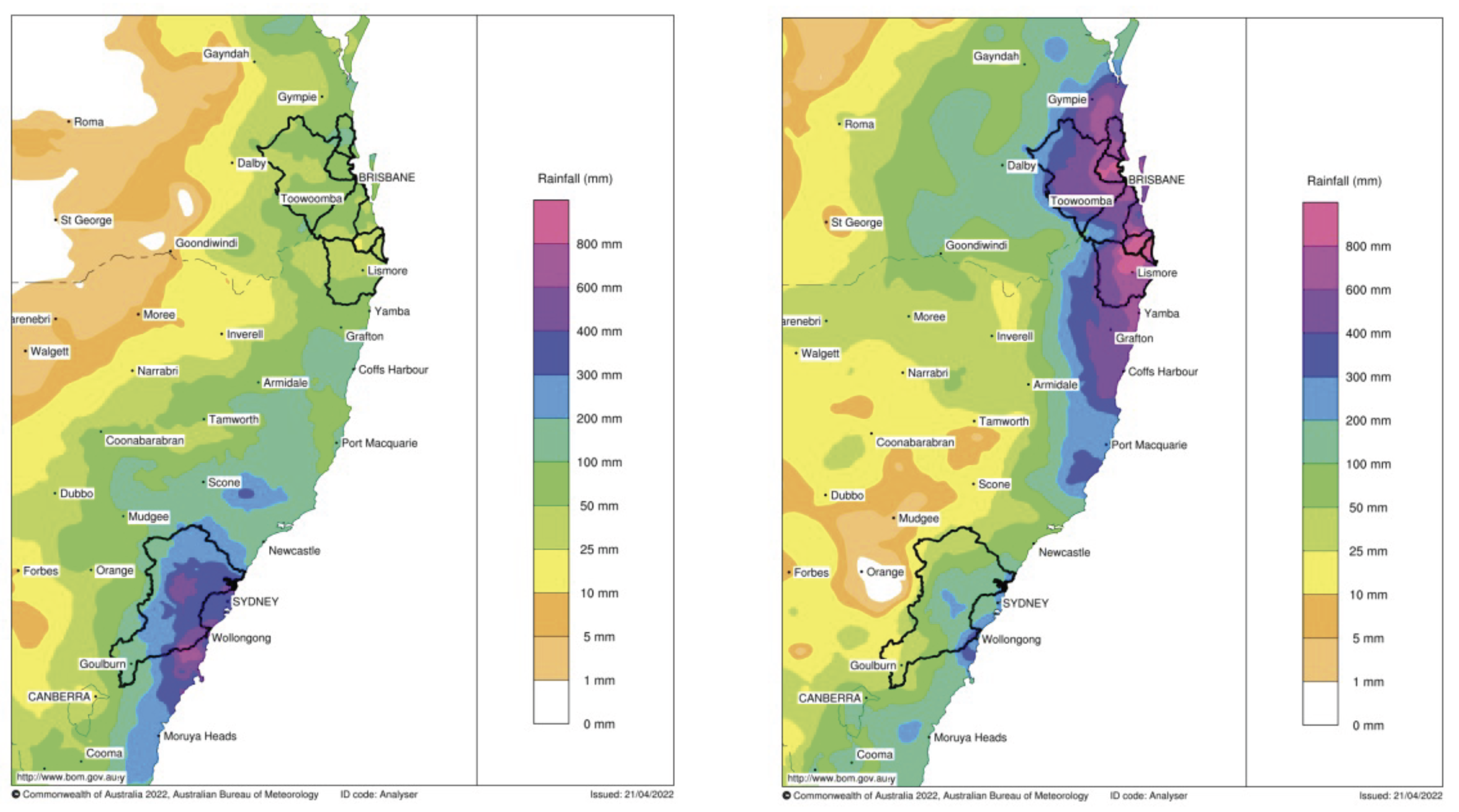
- Rainfall was 5 times the February monthly average for some areas of south-eastern Queensland and eastern New South Wales.
- Over 500 millimetres of rain fell during a two-week period in March 2022.
- The flooding caused loss of life and an estimated AU$3.35 billion in insured losses.

South-eastern Queensland and eastern New South Wales experienced a series of storms which caused persistent and heavy rainfall during the first half of 2022. The rainfall events broke multi-day rainfall records in many locations, with some regions experiencing over five times their monthly average rainfall.

Lismore, in north-eastern New South Wales, saw record breaking floods with flood levels 2 meters higher than the previous record set in 1954. The flooding between February and May 2022 was the costliest flooding event in Australia’s history, totalling an estimated AU$3.35 billion in insured losses across Queensland and New South Wales. They caused major disruptions to food supplies, fuel, transport, significant damage to infrastructure and the loss of over 20 lives.
This high impact flooding was a compound event, an event caused by multiple hazards or drivers. In this case, a combination of meteorological phenomena caused persistent, heavy rain to fall on catchments that were already sodden and primed for flooding due to a second consecutive La Niña event.

Event Explainer: What are Rossby waves
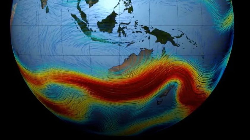
Rossby wave breaking was one of the main drivers of the weather experienced along the New South Wales and Queensland coastlines over much of February and March 2022. Rossby waves are building blocks of weather and are high-altitude, planetary-scale waves that are largely responsible for a variety of weather experienced at the surface. Rossby waves are distrubances in planetary waves such as the jet stream over Australia. As the waves get bigger, they may break just like those at the beach.
In late February 2022, the development of multiple rain producing weather systems was triggered by a Rossby wave breaking event south of Australia. The combination of a high-pressure system located to the southeast of Australia and a low-pressure system along the east coast transported moist air from the Coral Sea over Australia, while a slow-moving cut-off low provided the uplift necessary for rainfall. The persistence of these systems produced a prolonged spell of rainfall over the region, beginning in QLD and moving south to NSW (Figure 19). This resulted in flooding over south-eastern QLD (including Brisbane) and the Northern Rivers (including Lismore).
Similar Rossby wave breaking events and associated weather systems reoccurred several times throughout March and April resulting in multiple flooding events over eastern Australia including a second event in Lismore and Sydney.
As a new pressure system developed the conditions continued. On the 7th of April another heavy rain event caused more flooding over Sydney and southern New South Wales. There was record breaking rainfall across eastern and northern Queensland, as well as areas of New South Wales, into May 2022. The rain continued to the end of June.
Main research contact: Dr Michael Barnes | michael.barnes@monash.edu
The State of Weather and Climate Extremes 2022
Weather and climate extremes in Antarctica
Extreme events in 2022
Heatwaves in Western Australia
Extreme rainfall and flooding in Queensland and New South Wales February-March 2022
Record low Antarctic sea ice extent in 2022
Simultaneous Antarctic and Arctic heatwaves
Collapse of East Antarctic Conger ice shelf
Hailstorms in Queensland, Victoria and New South Wales
Damaging wind gusts in South Australia and the Northern Territory
© 2023 ARC Centre of Excellence for Climate Extremes
References and acknowledgements available in the PDF version available here.
Materials used are for educational purposes and either author provided or used under fair dealing provisions.
